
By: Ibrar Ul Hassan, Ali, Raza, Amjad, Ansar, Akhtar, Maisam
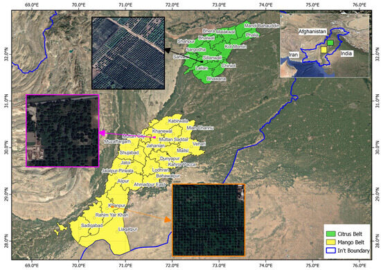
Accurate geospatial inventories of fruit orchards are essential for precision horticulture and food security, yet Pakistan lacks consistent spatial datasets at district and tehsil levels. This study presents the first national-scale, object-based Random Forest (RF) framework for orchard delineation and yield estimation by integrating multi-temporal Sentinel-2 imagery on Google Earth Engine (GEE) with high-resolution Pakistan Remote Sensing Satellite-1 (PRSS-1) data. Among the tested classifiers, RF achieved the highest performance on Sentinel-2 data (Overall Accuracy (OA) = 79.0%, kappa (κ) = 0.78), outperforming Support Vector Machines (OA = 74.5%, κ = 0.74) and Gradient Boosting Decision Trees (OA = 73.8%, κ = 0.73), with statistical significance confirmed (McNemar’s χ2, p 560 kg tree−1). The resulting multisensory geospatial inventory of citrus and mango orchards establishes a scalable, transferable, and operationally viable framework for orchard mapping yield forecasting, and resource planning, demonstrating the strategic value of national satellite assets for food security monitoring in data-scarce regions.